
Field Boundaries is the trusted layer of agricultural parcel data that underpins LPIS systems, insurance workflows, and digital agriculture services.
Through advanced satellite image segmentation, it delivers accurate, continuously updated field boundaries, enabling precise claims management, policy design, and portfolio risk tracking.
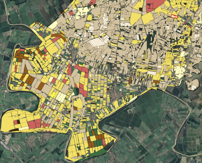
FieldBoundaries (LPIS) provides a trusted layer of agricultural field boundaries — the foundation for LPIS databases, insurance models, and digital agriculture platforms.
Why it matters #
- Fragmented or outdated field boundaries reduce accuracy in subsidy, insurance, and carbon programs.
- A standardized layer enables interoperability across agencies, financial institutions, and ag-tech providers.
- Like a “passport for fields,” it ensures consistent identification and tracking across systems.
Key features #
Accurate delineation — Extract clean, up-to-date parcel polygons from Sentinel imagery or orthophotos.
Automated updates — Detect splits, merges, or boundary shifts season after season.
Quality assurance — Built-in topology checks: fix overlaps, slivers, and self-intersections.
LPIS-ready outputs — Export GeoPackage, GeoJSON, or PostGIS with unique IDs and metadata.
API access — Integrate directly with existing systems and workflows through a secure, documented API.
How it works #
- Ingest recent imagery and the current LPIS database.
- Detect and refine candidate boundaries.
- Validate geometries and enforce topology rules.
- Compare with previous parcels to flag splits and merges.
- Export authoritative parcels, ready to update the LPIS.
Who benefits #
- Paying agencies — Maintain authoritative LPIS databases.
- Insurers and lenders — Access precise field extents for claims and risk models.
- Ag-tech platforms — Build services on stable parcel IDs that persist over time.